What’s an Airport Influece Zone?
Here’s what Google says, and see below for a map of the KLMO AIZ:
An Airport Influence Area (AIA), or Airport Influence Zone (AIZ), is a defined region surrounding a public-use airport where airport-related operations—specifically noise, overflight, and safety factors—significantly affect land use. Designated by local planning authorities in coordination with the FAA, these zones aim to ensure compatible land use, prevent hazards, and inform property owners.
Source: Federal Aviation Administration Airport Compliance Manual https://www.faa.gov/airports/resources/publications/orders/compliance_5190_6/order-5190-6c-compliance-chapter-20
Key components and characteristics of an AIA per FAA guidance include:
Purpose: To protect the airport from incompatible land uses (e.g., residential, high-density, or wildlife attractants) that could interfere with safety, navigation, or operational capacity.
Defining Factors: Boundaries are typically determined by noise contours (e.g., 65 DNL), flight tracks, and safety-related "imaginary surfaces" defined in FAR Part 77.
Restrictions: Areas often include "avigation easements" height limitations for structures, and prohibitions on uses that create electrical interference, glare, or smoke.
Implementation: These zones often require real estate disclosures to inform buyers of potential aircraft noise and activity.
The FAA advises that to ensure safety, land use in the immediate vicinity should be restricted to activities compatible with airport operations.
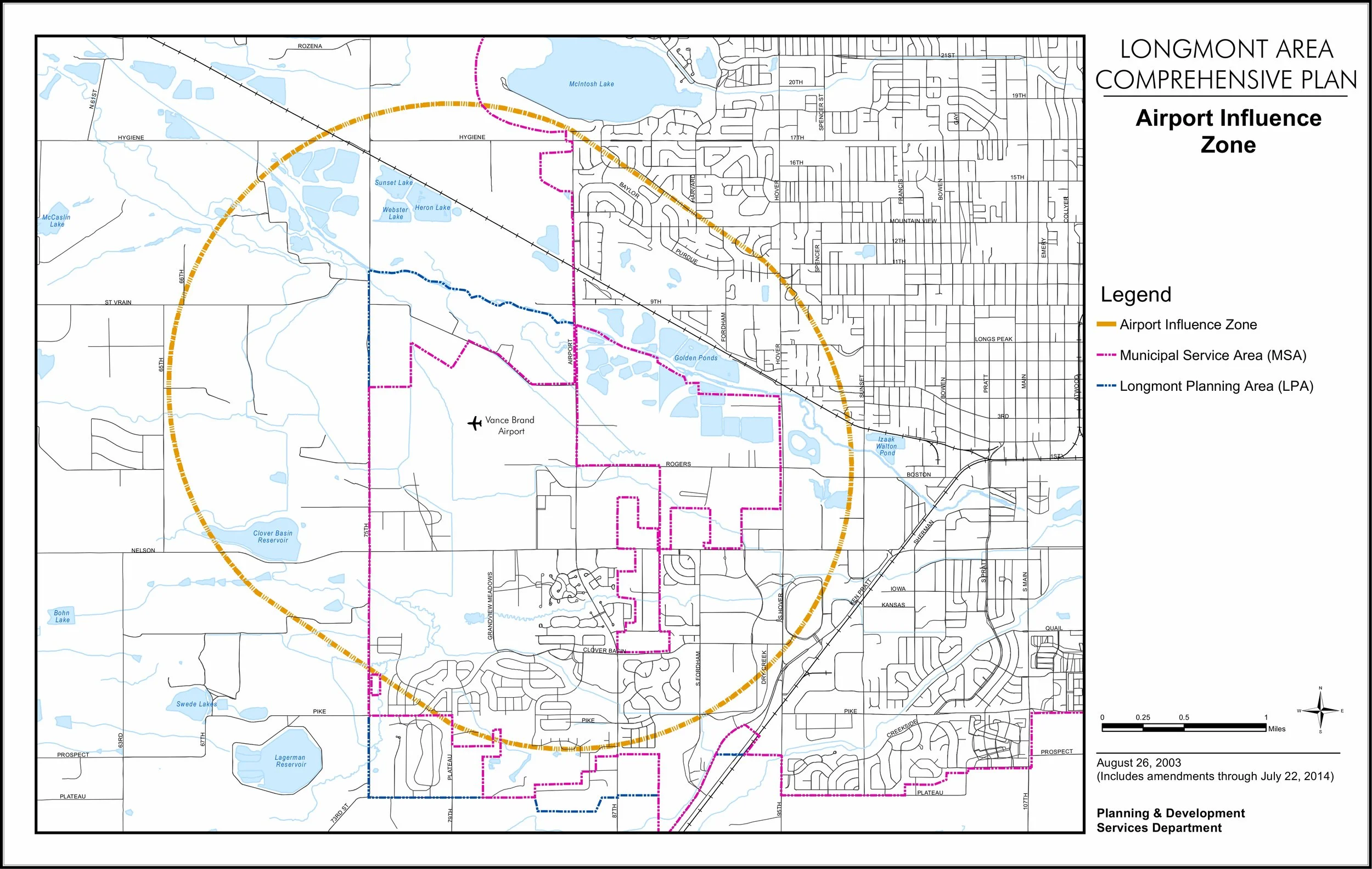
Here is the zone at KLMO: